
| Class | A |
|---|---|
| Deadweight | 3748 |
| Gross Tonnage | 2873 |
| Net Tonnage | ••••••••• |
| Length | 137 |
| Class Society | ••••••••• |
Ownership
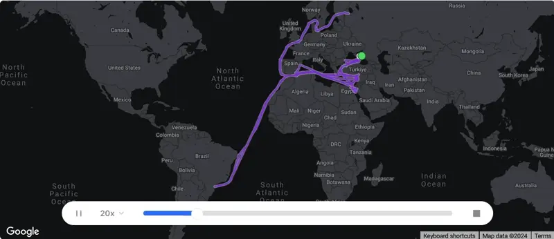
Voyage History
Survey Renewal & Certificates
| Code | Nature | Issued RO | Surveyed RO | Date of issue | Date of expire |
|---|---|---|---|---|---|
Summary
What's the identification number for ANYI?
What is the type and subtype of the ship?
Where is the ship?
What are the dimensions and carrying capacity of the ship?
What is the ship's destination, and when is its estimated arrival time?
Which flag does the ship sail under, and what's its call sign?
| Reported ETA | 21/04/2026 23:30 |
|---|---|
| Reported Destination | |
| Last Position Update | ••••••••• |
| Speed | 0 knots |
| Draught | ••••••••• |
| Heading | 39º |
| Course | 282.2º |
| Next Destination | MXATM |
| Navigation Status | 1 |
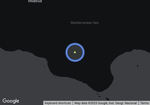
| Current Position | ••••••••• |
| Shipyard Country | |
|---|---|
| Builder (Shipyard) | |
| Year Build | 1991 |
| Keel Laid Year | - |
| Hull Type Code | ••••••••• |
| Engine Type (Builder) | ••••••••• |
|---|---|
| Engine Model | ••••••••• |
| Number of Main Engines | ••••••••• |
| Propulsion Type | ••••••••• |